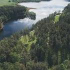
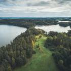
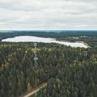
Highlands
Routes
Places to visit
Districts
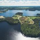
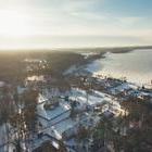
Zarasai
Ignalina
Utena
Moletai
Anyksciai
Information
About the project
Contacts
EN
LT
LV
RU
DE
Beginning
Routes
The general knowledge of the districts
The general knowledge of the districts
Trip progress
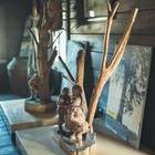
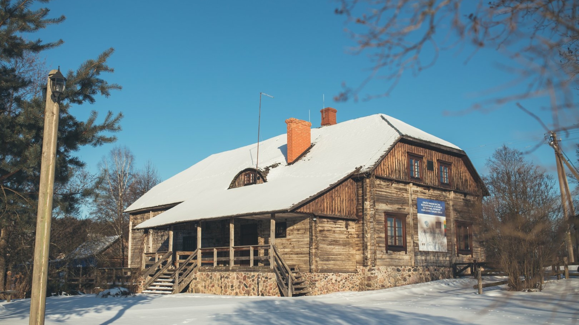
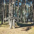
Former Stelmužė Manor
35 min.
Map
Stelmužė oak is the oldest and thickest growing oak in Lithuania and one of the oldest in Europe. It is believed that it can be around 1500–2000 years old, with 3.5 m diameter (just 8–9 men can to clasp in arms the stem) and 23 m high. But in the former Stelmužės manor park where grows this oak tree, you will find and more noteworthy objects. It would be not a mistake to say that the former place of Stelmužė Manor is a corner of living history. In the period of Livonia there...
15 km
15 min.
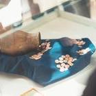
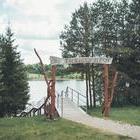
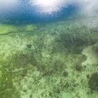
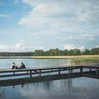
Beach of Zarasaitis Lake
1 h.
Map
Zarasai region is famous for its spectacular nature. The town is surrounded by seven lakes. Guests and tourists can enjoy various water attractions in Zarasai town. Beach of lake Zarasaitis surrounded by the pine forest has well-groomed environment and infrastructure that suits for water entertainments. There is an open-air swimming pool with tracks and gates for playing water polo. Here you can try a water blob, hire a kayak or a boat, you can play volleyball or table football on a...
2.1 km
< 10 min.
The Great Island of Zarasas Lake
1 h.
Map
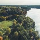
The Great Island of Zarasas lake is like a heart of the town, which warmly welcomes and locals and strangers, who comes to visit it. It seems incredible, but the island covers an area of 44 ha. There was an area, where trees were raised for greening of the town and now here is the main place for sport and cultural events. There is also the town beach. The Great Island is in one the largest lakes of town, occupying more than 313 ha. During the First World War, the island was connected to...
1.3 km
< 10 min.
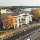
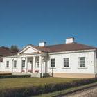
Building of Zarasai Area Museum / Building of Zarasai Public Library
1 h.
Map
Zarasai Area Museum and public library are in Zarasai, near the famous Observation Wheel and Zarasas lake. Impressive, pillared house erected in 1931. The chairman of the building commission was the teacher and director J. Steponavičius and the architect of the school project building was J. Selenekas. The schoolhouse was in classical style with attention drawn to the central part decorated with 4 orders of columns. Until 1935 there was a higher commercial school, later it was renamed...
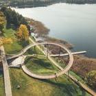
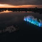
Zarasas Lake observation wheel
1 h.
Map
If you are looking for a place where you could see unseen spectacular view and will find simple way to relax, you should visit a unique Zarasas lake observation wheel, and there you can enjoy panoramic view of Zarasas lake. This exclusive architectural construction was opened in autumn of 2011. It is 17 meters high and the diameter of the circle is 34 meters. 100-meter-long building opens enchanting view of Zarasas lake. Here you can also get to know the cultural space – park of stone...
4.4 km
< 10 min.
WW1 fortification line of German army
1 h.
Map
The First World War started in Zarasai a little later than in other terrain. On 17 September 1915, the Germans came closer to Zarasai. When the German forces were approaching, the Russian army destroyed a highway bridge and retreated towards Latvia. Pioneer soldiers repaired the highway bridge of the town. Later on the German infantry division began to flow into town through all the roads. Before spring flooded German soldiers the town. When the front has stabilized, they started war of...
19 km
20 min.
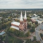
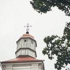
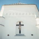
Church of the Blessed Virgin Mary of Sorrows in Salakas
1 h.
Map
In Zarasai district, near Lake Luodis is located Salakas town decorated with a unique church built entirely of rough-hewn stone. This sanctuary proudly standing on a hill leaves an unforgettable impression for its monumentality and sky-reaching tower. The height of Salakas Church of the Blessed Virgin Mary of Sorrows inspired by the neo-romantic style, with features of neogotic is 72 m. This holly place is a little farther away from centre of city, but it seems like she is observing the life...
19 km
20 min.
Memorial Museum of Adomas Hrebnickis
1 h.
Map
In the northern part of Ignalina district, near Beržininkai Lake, there is a small village with an intriguing name Rojus (Paradise). As it could be expected, not only the name, but also the history of this village is very interesting. It was established in 1890 by a famous professor of that time, explorer of fruit trees and developer of new varieties Adomas Hrebnickis. Up until then, the region belonged to the scientist’s father-in-law and was called Velnynė (place full of...
30 km
30 min.
Ignalina Area Museum
1 h.
Map
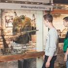
When traveling in the surroundings of Ignalina, do not forget to visit the city itself. In case you are going to want to know the customs, culture and history of this region full of lakes and forests, visit Ignalina Area Museum, which is situated here. It contains several exhibitions, showing the ancient customs, crafts and lifestyle of the residents from Ignalina. The ethnographic exhibition contains various items, tools and devices used in the 19th and 20th century: antique irons,...
4.5 km
< 10 min.
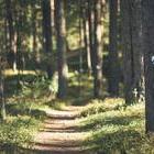
Botanical Trail (Nature trail)
1 h.
Map
Palūšė is a pearl of the Highlands and a capital of the National Park, which is a perfect place to enjoy water amusement, get some rest and get acquainted with the history of this region. This is also a place which will not disappoint those, who love walking on the nature trails. There is a botanical (nature) trail established between the villages of Palūšė and Meironys near the Lūšiai Lake, which is 3.5 kilometres long and can be tackled going by foot or riding a...
160 m
< 1 min.
Burial mound exhibition and a Sone Age hut in Palūšė
1 h.
Map
Among other interesting things for travellers and vacationers, Palūšė, which is called a capital of Aukštaitija National Park, offers to see ancient burial mound exhibition and a Stone Age hut. Exhibition established near the famous wooden St. Joseph’s Church contains an exact copy of one burial mound found in Palūšė. Even though it is not real but after seeing the laying natural-sized human skeleton which cannot be distinguished from a real one right...
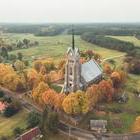
Wooden Palūšė Church with a bell tower
1 h.
Map
Wooden Palūšė St. Joseph’s Church greets its visitors in Palūšė village. Everything here is taking place in the natural surroundings – close to many lakes and rivers that are intertwined with each other. Palūšė Church stands out in such a landscape, as it was built without any iron nails, using only an axe. The distinctive architectural forms that were created with an octagonal bell tower (the only one like this in Lithuania) will impress even those...
13 km
15 min.
Ginučiai Mound
1 h.
Map
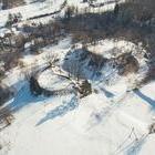
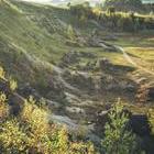
Ginučiai Mound can be found in Aukštaitija National Park, near the western border of Ignalina district, between the lakes Linkmenas and Ūkojas. Even though now it is covered in forest, you can see right away that this is one of the greatest and most impressive mounds in Lithuania. In fact, this is not one, but a complex of two mounds, which are divided by a small valley. The high and steep slopes as well as a sufficiently wide site testify that there was once an important castle,...
Ladakalnis
1 h.
Map
Many legends are told about Ladakalnis, previously called Ledakalnis, which can be found right by the impressive Ginučiai Mound. This is one of the most spectacular objects to visit not only in Ignalina district, but ir Labanoras Regional Park and the whole Aukštaitija National Park. The hill, which is 176 m high, is a geomorphological monument of nature, which will present you with a truly unforgettable view. From the top of Ladakalnis, six lakes can be seen, situated between...
1.4 km
< 10 min.
Ginučiai Watermill
1 h.
Map
Ginučiai Watermill is one of the most memorable symbols of Aukštaitija National Park. Wooden building of the mill reminding of the old days as well as the bridge and the dam often become a pivot from which the travellers start their acquaintance with this region of Lithuania, engraved with lakes and full of picturesque landscapes. Ginučiai Watermill was built in the second half of the 19th century on the Srovė River and was working until 1968. This one-storey mill with a shelter...
1.8 km
< 10 min.
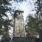
Šiliniškiai Observation Tower – Observation Deck
1 h.
Map
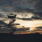
Aukštaitija National Park has a place which is often visited not only by those who are eager to look at the spectacular views of the park but also by the residents of the local surroundings, who want to brighten their everyday life. Šiliniškiai Observation Tower with its exceptional form is the first observation deck in Lithuania, which is established on the antenna tower of mobile telecommunications. After adopting a common agreement with Aukštaitija...
4.5 km
< 10 min.
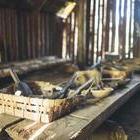
Beekeeping Museum
1 h.
Map
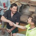
Those who are driving towards Ignalina or visiting Aukštaitija National Park simply must stop by the Museum of Ancient Beekeeping, situated in Stipeikiai village, where both the small children and adults will have a great experience. A museum, established on the shore of Tauragna River is the only one of such kind in Lithuania, which cherishes the traditions of beekeeping. Bronius Kazlas, who had started this museum in 1984, probably did not expect that even after three decades...
9 km
< 10 min.
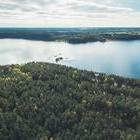
Shore of Tauragnas Lake
1 h.
Map
The deepest lake in Lithuania – Tauragnas – meets the visitors in Aukštaitija National Park, Tauragnas town, which is only 15 kilometres away from Utena. Winding lines of the lake, high bank and clear water makes this miracle of nature even more charming. In summer, the shore of this lake is a big gathering place for nature lovers. This place attracts families with children, fishermen and travellers. Holidaymakers and tourists coming to the recreation site “The...
21 km
20 min.
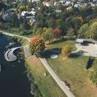
Dauniškis park and a fountain
1 h.
Map
Dauniškis park and the fountain is one of the most impressive places in the city of Utena. What impresses most is the fact that Dauniškis lake, after which a nearby park takes its name, is comforably situated in the town centre surrounded by houses, streets, a pine grove and the Chapel of St. Virgin Mary, Queen of Martyrs. In 2011, when Utena was celebrating the 750th anniversary, Dauniškis Lake was decorated with the illuminated and playing fountain. park and...
860 m
< 1 min.
Complex of post station buildings
1 h.
Map
At the beginning of the 19th c., Russia was seeking to fully consolidate its power in the relatively recently occupied territories of the former Lithuanian and Polish state. Among other measures that were taken, the connections and communication between the capital Saint Petersburg and the western provinces of the country needed to be improved. A connecting artery was constructed, which at the time was called tract Saint Petersburg-Warsaw. Meanwhile, a small city of Utena had an...
Utena Local Lore Museum
1 h.
Map
If you are staying in Utena and would like to know more about the history and customs of this region, you should visit Utena Local Lore Museum. In the exhibition of crafts and trades in the museum, you will see what tools were used by the residents of Utena at the end of 19th c. – at the beginning of 20th c., when cultivating the land and engaging in crafts. The museum stores authentic ploughshares, threshers as well as tools for sowing and harvesting. The exhibition of the blacksmith...
1.6 km
< 10 min.
Museum of Freedom Fights
1 h.
Map
When staying in Utena, you should definitely visit a division of the Utena Local Lore Museum, called Museum of Freedom Fights, established in the narrow-gauge railway station, which was working until 1983. Currently, it has a modern exhibition, presenting the history of narrow-gauge railway Panevėžys- Švenčionėliai, retelling the story about the painful division of Europe as a result of secret protocol agreements in 1939, about forced participation of Lithuanians in the Second...
2.8 km
< 10 min.
Narkūnai Mound
1 h.
Map
Just as you arrive to Narkūnai Mound, you will be able to feel the special spirit of this place. The hill which has decorated its steep hillsides with tall and strong trees, preserves history covering many centuries. People have been living here from the very old days – this mound, situated on the shore of Utenėlė River is dated even one thousand years B.C. – 2nd c. A.D. and 14–15th c. The mound was examined more than once. In 1835, Pranciškus Vilčinskis, who...
12 km
10 min.
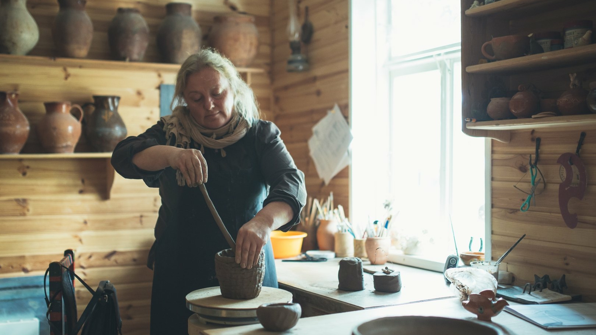
Vytautas Valiušis Ceramics Museum
1 h.
Map
After visiting plenty of historical and natural objects in the Highlands region, you should also visit Vytautas Valiušis Ceramics Museum, situated in Leliūnai, Utena district. In this museum you will be welcomed by the owner himself, who is a folk artist, titled the king of potters in Lithuania, Vytautas Valiušis. In fact, he was the one who had an idea to create this museum and had established it in the abandoned premises, using his own funds. Only some time later, in...
11 km
< 10 min.
Observation Tower in Bijeikiai
< 1 min.
Map
In case you are searching for a place where you could look at part of the Anykščiai Regional Park from above, we would like to invite you to climb up the Observation Tower in Bijeikiai. It is rather easy to find a way to the tower. Bijeikiai Observation Tower is between the villages of Burbiškis and Mačionys and you will reach it by driving the road 1221 (Burbiškis-Mačionys-Leliūnai). The tower stands here from 2010. Car parking lot and passages were created as...
15 km
15 min.
Museum of Angels – Centre of Sacred Art
< 1 min.
Map
The Centre of Sacred Art which contains a famous Museum of Angels is established in the very centre of Anykščiai. The first museum in Lithuania of such kind has a very interesting history, since its initiator and founder is a Lithuanian living abroad Beatričė Kleizaitė–Vasaris who came back to her homeland after the winds of freedom started blowing. The beginning of this museum was a painting which was gifted to her by the painter Jonas Daniliauskas, called “An angel...
The Observation Deck of the Church of St. Matthew
< 1 min.
Map
When visiting Anykščiai, do not miss a chance to kill two birds with one stone, by visiting the impressive Church of St. Matthew the Apostle and Evangelist and to look over the town and its suburbs from up above. The towers of a neo-gothic church which was built more than one hundred years ago in Anykščiai are being seen from far away. This is the highest church in Lithuania, since the height of the towers is 79 meters. You can also climb up to the observation deck...
320 m
< 1 min.
Writers’ Hill
< 1 min.
Map
Anykščiai is an exceptional town of Lithuania, where you can visit lots of places both in summer and winter, starting from the entertainment and recreational areas and finishing with sightseeing and educational ones. Anykščiai has the first memorial museum in Lithuania, which was established in 1927 with the efforts from the writer Antanas Žukauskas-Vienuolis in the granary belonging to the poet Antanas Baranauskas. Later on, the museum was named A. Baranauskas and A....
Trips on the Narrow Gauge Railway train and Narrow Gauge Railway Museum
< 1 min.
Map
Narrow Gauge Railway, often gently called “Siaurukas”, is a unique technical monument, stretching in the eastern Highlands, from Panevėžys up to Rubikiai, situated close to Anykščiai. This is one of the current symbols of Anykščiai which is very popular both among the tourists from Lithuania and from abroad. Here you can try regular trips, taking place from May until October, participate in the celebratory and educational trips organised during the whole year...
2.3 km
< 10 min.
Kalita Hill
< 1 min.
Map
It does not matter whether it is winter or summer, there is such a place in Lithuania where the fanatics of adrenaline and heights can meet. Kalita Hill situated in Anykščiai is a perfect place to experience something new, to get re-energised and have a good time. This hill also reminds of some historic times – it is said that once at the foothill there was a manor standing here, which belonged to the nobleman Nykštis which is associated with the story behind the name of...
3.2 km
< 10 min.
Šeimyniškėliai (Voruta) mound
< 1 min.
Map
Probably everyone has heard about the first capital of Lithuania – throne castle of King Mindaugas, called Voruta? Even though historians and archaeologists still do not agree on its exact place, one of the most likely places is Šeimyniškėliai mound with its hillfort in Anykščiai district, right near the northern town border of Anykščiai. This speculation is also based on the fact that a strong wooden castle was built here around the middle of the 13th...
7 km
< 10 min.
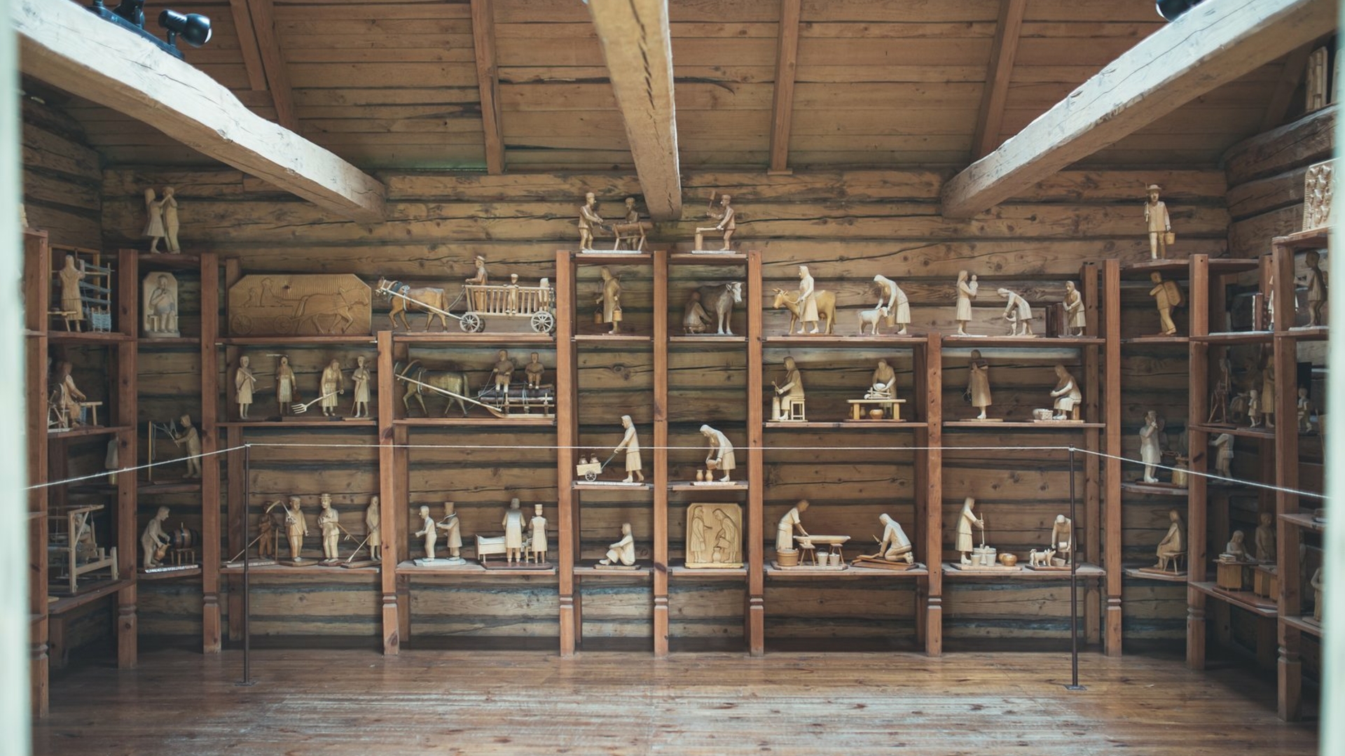
Horse Museum
< 1 min.
Map
The unique Horse Museum is the only of its kind not only in Lithuania but also in the Baltic countries. The professor of agronomy Petras Vasinauskas thought of establishing this place and implemented this idea in 1978. Three years before opening the museum in Niūronys, Anykščiai district, a proactive scientist has created an original campaign which does not have any analogies up until these days – he has travelled more than 1500 km through Lithuanian roads in a little more than...
11 km
< 10 min.
The Light of Happiness
< 1 min.
Map
Probably not many people know where Liudiškiai Hill is situated, but it is enough to visit it once and you will remember why this place is so special for the rest of your life. The Light of Happiness standing on Liudiškiai Hill is a tombstone monument for the writer Jonas Biliūnas and was named like this for a reason. The Lithuanian literary classic died in 1907 in Zakopanė, at the foothill of Tatra Mountains when he was only 28 years old. However, the will of J. Biliūnas...
7 km
< 10 min.
The Treetop Walking Path and Puntukas Stone
< 1 min.
Map
Recently, one of the leading tourist attractions in Lithuania is the Treetop Walking Path. The path is 300 meters long with the highest place reaching 21 meter. The path is made from steel and concrete structures which create a possibility for the visitors to look at the Pinewood of Anykščiai from above. While the gaze is wandering around the treetops, it seems that you look at the Šventoji River, Anykščiai and the suburbs from the bird’s eye. When you climb...
38 km
35 min.
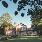
Farmstead of a Alanta Manor
1 h.
Map
Neo-romantic style Alanta Manor House can be found in Naujasodis Village, Molėtai district, which is situated right by the town of Alanta. Palace of an exceptional facade, built in the middle of the 19th century, had recently been restored again, by maintaining their authenticity. Not only the main building of the manor but also the whole complex of the buildings and a well-maintained park with three small ponds have remained up until the current days. This is the reason why nowadays...
16 km
15 min.
Commercial buildings of Molėtai (Jewish trading house from the beginning of the 20th c.)
30 min.
Map
In the centre of Molėtai, at the crossroad of the two main streets, an old red-brick building always attracts an eye. We would like to suggest you to pause and briefly touch the history, since those are commercial buildings of Molėtai – Jewish trading house from the beginning of the 20th c., which has survived many fires, destroying the town. The Jewish had settled in Molėtai in the 18th century and on the second half of the 19th century they have already accounted for around 80...
210 m
< 1 min.
Molėtai Sculpture Park
1 h.
Map
Molėtai Sculpture Park is situated at the outskirts of the town by the Pastovis Lake, therefore it is a perfect place not only to take a walk and to enjoy the peacefulness in the shelter of nature but also to admire the works created by the artists. Contemporarily equipped park under the open sky exhibits various works made of wood, black, grey and brownish granite, created by sculptors-architects from Lithuania, Wales, France and Poland. Two young artists Dalia Cibauskaitė and...
3.8 km
< 10 min.
Luokesai ancient settlement, Luokesai ancient settlement II
30 min.
Map
Luokesai Lake situated near Molėtai is an important place for the history of Lithuania. In the year 2000, for the first time in Lithuania, archaeologists had discovered remains of an ancient settlement built on the stilts. After a year, the remains of the second similar settlement were found in the same lake. The settlements are situated near the shore, in a shallow place and are around 600 meters from each other. The lake has a total of around 400 stilts rammed into the bottom which...
10 km
< 10 min.
St. Lawrence Church of the Repentance Canons Monastery ensemble
1 h.
Map
St. Lawrence Church of the Repentance Canons Monastery ensemble in a small Videniškiai town is a significant architectural building which is worth visiting by everyone who is not only interested in history, architecture and culture but who wants to find peacefulness of soul and revival in a cosy village church, where on the right side you will find a square chapel built with a huge cellar. This was the place where the representatives from a very well known Dukes Giedraičiai family...
20 km
20 min.
Lake Fishery Museum, Antanas Truskauskas Hunting and Nature Exhibition (divisions of Molėtai Area Museum)
1 h.
Map
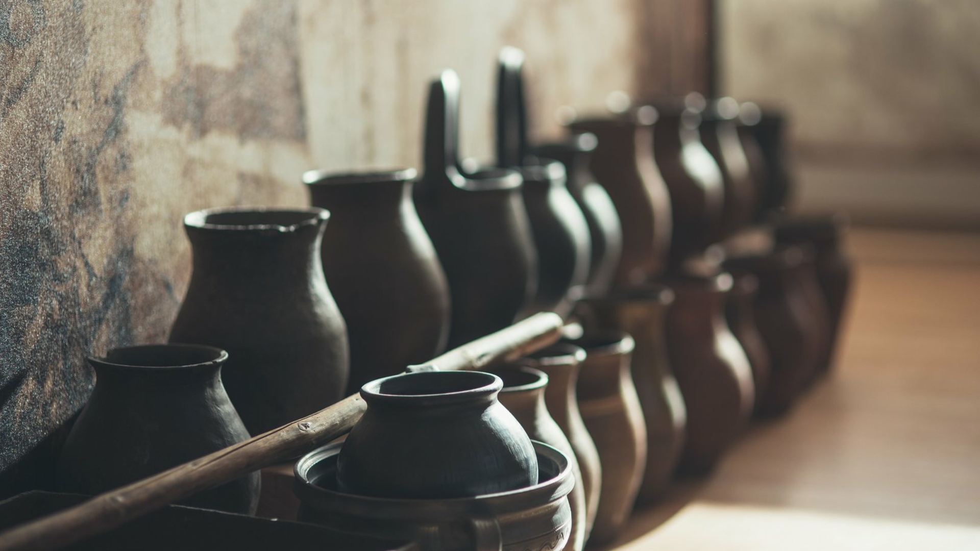
Lake Fishery Museum is a unique place, where you will find everything that is related with fishery in the lakes: from various fishing tools up to the rarest fish which can be found in the lakes. You will also get acquainted with ancient fishing and how this business was changing as the years gone by. The museum is established in the ethnographic farmstead of a fisher, which was rebuilt in the 19th century, consisting of the wooden hut and a barn typical for the Highlands, situated in...
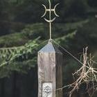
Observation Tower of Labanoras Regional Park
30 min.
Map
Labanoras Regional Park is the biggest regional park in Lithuania and its surroundings are exceptional by the variety of landscapes as well as especially rich flora and fauna. Therefore, the nature lovers are gathering to this place for a long time now and their numbers have grown after building an impressive tower to look around the surroundings, which is otherwise called Mindūnai Observation Tower. You can reach the tower, exceptional by its impressive form, through a forest road with...
21 km
20 min.
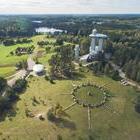
Ethnographical Farmstead and the Ancient Observatory of Celestial Bodies (division of Molėtai Area Museum)
1 h.
Map
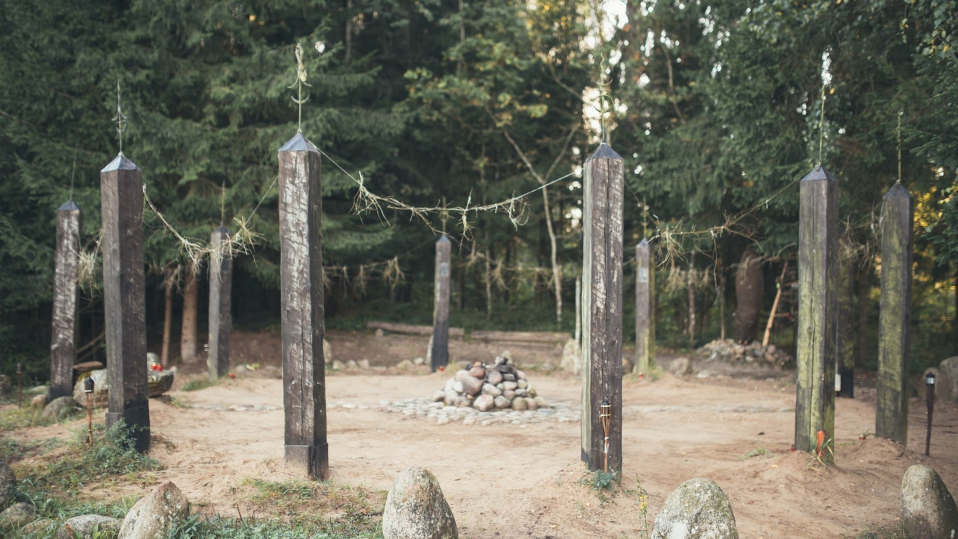
When driving the cosy road on the picturesque shore of Lenktinis Lake, you will reach the Ethnographical Farmstead, which is a traditional cottage typical for the Highlands. Here you will see the remaining buildings of an old ethnographic farmstead: a cellar and a barn. A traditional two-sided farmhouse was also built near them. Right by the Ethnographical Farmstead there is an Observatory of Celestial Bodies – a sacred place. Prepare to go back to the ancient times and get acquainted...
1.2 km
< 10 min.
Lithuanian Museum of Ethnocosmology
1.5 h.
Map
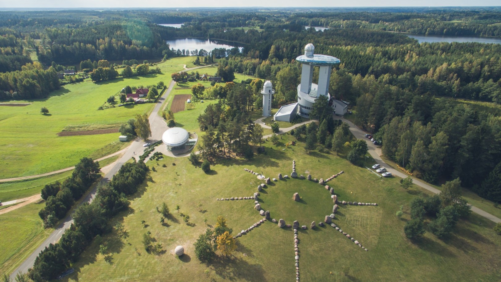
Lithuanian Museum of Ethnocosmology is one of the mostly visited places in Lithuania by the tourists from abroad. It was established in Molėtai district, near Kulioniai village, a little farther from Molėtai Astronomical Observatory, close to the mound. Museum of Ethnocosmology is also called astronomical pavilion of special purpose, since its three constitutive parts – underground gallery with five halls, observation tower with a telescope and an outer exhibition create an impression...
38 km
35 min.
Former place of Dubingiai Castle, called the Hill of the Castle (Dubingiai bridge)
1 h.
Map
The Hill of the Castle can be found in the exceptionally beautiful peninsula of Asveja Lake, where a very important Dubingiai Castle used to stand some time ago in the past. You will be able to experience the beauty of these surroundings when driving towards the former place of the castle. The Asveja Lake stretching for around 30 kilometres is exceptional by its deeply carved shores, framed by hills covered in forests, which are reflected in the clear water of the lake. After climbing up the...
71 km
1 h.
Vyžuonos St. George Church
1 h.
Map
There is probably only a very small number of people who could realise what a great history Vyžuonos St. George Church, standing in Utena district, contains, when visiting it, as it has survived the times of Vytautas Magnus. church was built in the middle of Vyžuonos town in 1406, following the model which was widely spread in GDL at the time, including a square plan three-nave hall with a five-wall apse. The one-tower church is with three naves, which are covered with the cross-vaults,...
10 km
< 10 min.
Šeimyniškiai Exposure with a conglomerate rock
1 h.
Map
If you want to feel the greatness of the rocks, you do not need to go abroad, as you can also see them in Lithuania. In Užpaliai town, situated in Utena district, you will find Šeimyniškiai Exposure with a conglomerate rock, which will leave a lasting impression. Previously, this place was a gravel quarry, therefore, the locals better know it as Šeimyniškiai quarry. When digging the gravel, massive blocks formed from clay, gravel and small pebbles were...
10 km
< 10 min.
Shore of the Alaušas Lake
1 h.
Map
Shrouded in legends and a beautiful Alaušas Lake is a real pride of Utena region and is the tenth lake of the country by size (area 1071.8 ha). According to one of the legends, there has been a castle on Maneičiai Mound belonging to the Duke Alaušas, which was standing on the eastern shore of the lake. The story tells that the duke really liked this huge and clear lake, therefore as he was dying, he asked to throw his ashes to the waters of this lake. People had followed his...
19 km
20 min.
Cultural centre Dusetos Art Gallery
1 h.
Map
On the east of Zarasai district, near Sartai Lake is a small town Dusetos which is very well known in Lithuania for winter-time horse racing. However, this is not the only its uniqueness. Dusetos is also famous for its especially active cultural life. The main axis is here a modern Cultural centre Dusetos Art Gallery. Here are constantly arranged exhibitions, plein air paintings, symposiums. In the hall are presented performances, movies, concerts, get-togethers, creative evenings and...
9 km
< 10 min.
Antazavė Manor
1 h.
Map
In Antazavė, on the northern shore of Zalvė Lake, is neoclassical manor house, which formerly belonged to the famous family of Plater. The masonry building was built at the end of the 18th century, fallowing a design by Antanas Naglovskis, by the order of the countess Kunigunda Plater. Also here were built two Oficina buildings, a church, a presbytery, an almshouse and an inn. There are some written sources about large, interesting and rebellious family of Earl Platers: about Tadeusz...
16 km
15 min.
Apparition place of St. Virgin Mary and a chapel
1 h.
Map
There is a place in Zarasai district, which attracts thousands of pilgrims from Lithuania and abroad. It is the place of Apparition of St. Virgin Mary in Kvintiškės village near Ilgis Lake. This is not ordinary but a holy place with the history dating five decades back. According to the stories, on 30 June 1967, two teenagers noticed a light on Ilgis Lake and saw a young girl of extraordinary beauty wearing white dress and a cape, who was standing on a rotten pole. The teenagers...
Route
50 objects on the route
2 d..
500 km
Road surface
70 % asphalt
10 % dirt road
20 % forest path
Try it out
Mobile application
Išbandyk išmaniąją programėlę
Keliautojai, norintys išsamiau pažinti Anykščių kultūros paminklus, literatūrines vietoves, pasiekia ir atokų.
Download the route
File
Share
Gallery